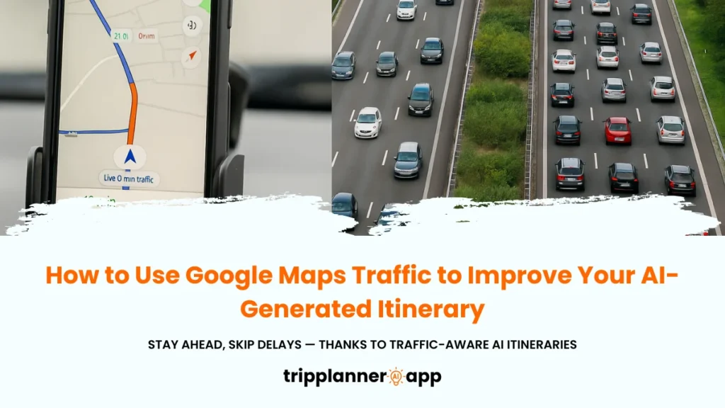
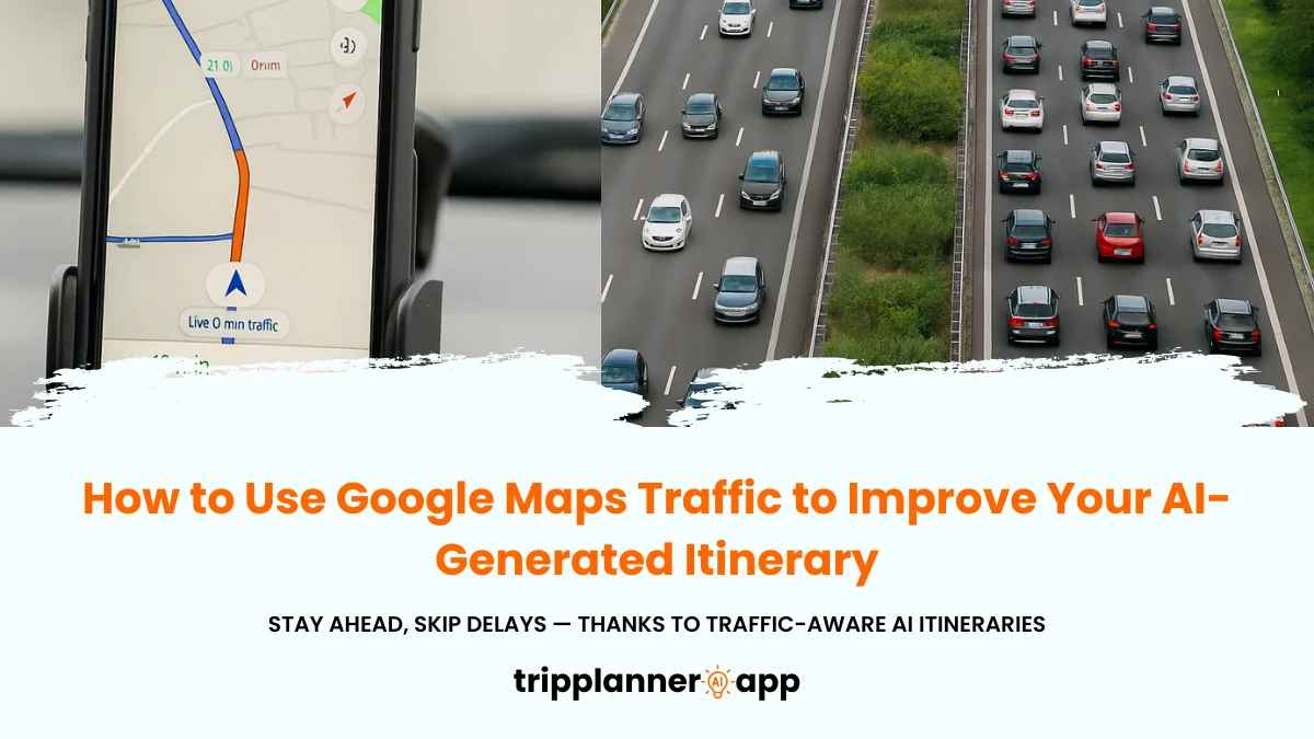
Imagine embarking on a trip that’s fraught with unforeseen traffic jams, unexpected road closures, and delays that keep throwing your well-laid plans into disarray. Now, picture a solution that not only trivializes these travel pitfalls but enhances your journey by integrating Artificial Intelligence (AI) with Google Maps’ real-time traffic insights. This seamless fusion doesn’t merely facilitate navigation, it revolutionizes your travel experience by forecasting traffic patterns, suggesting alternate routes, and optimizing itineraries for efficiency and convenience. Dive into this guide to unlock the secrets of elevating your itinerary with Google Maps’ traffic data!
Introduction
Traffic data stands as a critical pillar in travel planning, providing the real-time insights necessary for navigating the unpredictable nature of road conditions. Google Maps, equipped with advanced traffic data capabilities, is an invaluable tool for optimizing your travel experience especially when paired with AI-generated itineraries. This guide explores the intricacies of leveraging Google Maps Traffic features to revolutionize travel planning, promising a hassle-free journey tailored to meet your preferences.
Why Traffic Data Matters When Traveling
In the bustling arena of travel, understanding and applying traffic data are non-negotiable skills. Traffic information not only guides your journey but ensures its efficiency. Here’s why traffic data is a fundamental asset:
- Time Efficiency: Real-time traffic data informs you of the latest conditions, allowing you to dodge congested areas effectively. Imagine aiming for a 30-minute drive only to find it stretched to an hour due to unexpected traffic; this is where behavioral insights into traffic data play a pivotal role.
- Cost Management: With precise traffic data, you’re less likely to waste fuel in gridlocks, which saves money. Given rising fuel prices, avoiding stop-and-go traffic is financially prudent.
- Stress Reduction: There’s peace of mind when you’re armed with data. By embedding these insights into your journey, you alleviate the stress linked with uncertainty and avoid delays.
- Enhanced Safety: With up-to-date traffic information, your awareness of possible road hazards improves, allowing for informed decisions such as choosing alternate routes instead of risky paths.
Without traffic data, spontaneity can easily morph into chaos. Thus, whether you’re commuting daily or embarking on a cross-country tour, embracing traffic data is fundamental to a streamlined journey.
How Real-Time Insights Improve AI Trip Planning
Embracing AI technology in trip planning transcends traditional methods, crafting it into an art form enriched with precision and personalization. AI, with its ability to process and interpret vast datasets, revolutionizes how we perceive trip organization:
- Dynamic Route Adjustments: Through accessing live traffic data, AI dynamically recalibrates routes in response to real-time traffic conditions, predicting and adapting on-the-fly to ensure prompt arrivals.
- Predictive Analysis: Leveraging historical data and traffic predictions, AI evolves your navigation into a proactive framework, foreseeing potential slowdowns or congested areas, thereby tailoring routes to suit these insights.
- Personalized Experience: AI accommodates individual preferences be it avoiding toll roads or preferring scenic routes personalizing recommendations to match user priorities.
- Minimizing Disruptions: The synthesis of real-time insights with AI technology minimizes disruptions, providing proactive rerouting ahead of emerging traffic concerns.
By melding real-time data with AI, the relationship between planning and the traveled pathway strengthens, elevating journey experiences from routine to optimal.
When Should You Use the Google Maps Traffic Feature?
The strategic use of Google Maps’ traffic insights can dramatically impact your travel efficiency. Whether it’s around peak hours or during an unexpected delay, here’s when activating the traffic feature is most beneficial:
- Commuting During Rush Hours: Commute smoothly by strategically deploying traffic data to bypass congested main routes, finding faster alternatives that adjust dynamically with traffic flow.
- Time-Sensitive Appointments: For journeys that cannot afford timing errors like reaching the airport the traffic feature forecasts possible delays, optimizing departure times.
- Urban Adventures: While navigating bustling cities or unfamiliar streets, this feature provides real-time congestion data, helping avoid tricky traffic spots.
- Road Trips and Long Drives: Use the feature to uncover uncharted detours, offering scenic yet traffic-minimized paths.
Engaging the traffic feature when the stakes are high ensures you remain on course, regardless of outside interference, formulating a journey fortified by data.
How to Enable the Traffic Layer on Google Maps
Integrating traffic data into Google Maps enhances the navigation experience by providing real-time updates. Activating the traffic layer on your device offers visibility into congestion patterns and potential delays, leading to more informed route choices. Engage this layer on both mobile and desktop platforms for comprehensive travel planning.
Step-by-Step on Mobile (iOS/Android)
Activating the traffic layer on mobile devices transforms the Google Maps experience:
- Launch the Google Maps App: Begin by opening the app on your mobile device.
- Access the Layers Menu: Located in the upper right corner, this icon, resembling stacked layers, opens a multi-option menu.
- Enable Traffic Layer: Select ‘Traffic’ from the menu, witnessing roads re-color in real-time. This color-coded feature extends insights into traffic dynamics, including road closures or incidents.
- Analyze Traffic Conditions: Once in place, analyze the different color codes green for free-flow, orange for slowdowns to discern patterns and adjust plans.
Mobile navigation with the traffic layer brings immediacy to trip adjustments, showcasing real-time road conditions, making informed navigation decisions more accessible.
Step-by-Step on Desktop
Enabling Google Maps traffic insights on desktops maximizes the strategic planning of your travel:
- Visit Google Maps Online: Start by navigating to maps.google.com.
- Unveil the Layers Options: Locate this button at the map’s bottom-right and expand it to reveal multiple layers, including traffic.
- Activate Traffic Layering: Click ‘Traffic’ within this section to unveil real-time road statuses, displayed in various colors symbolizing congestion severity.
- Monitor Updated Traffic Flow: Continuously maintain updated insights by refreshing the screen, as road conditions evolve rapidly.
Google Maps transforms from a basic navigation tool into an anticipatory system adept at reinforcing your travel adjustments, preparing you to face fluctuating traffic situations with ease.
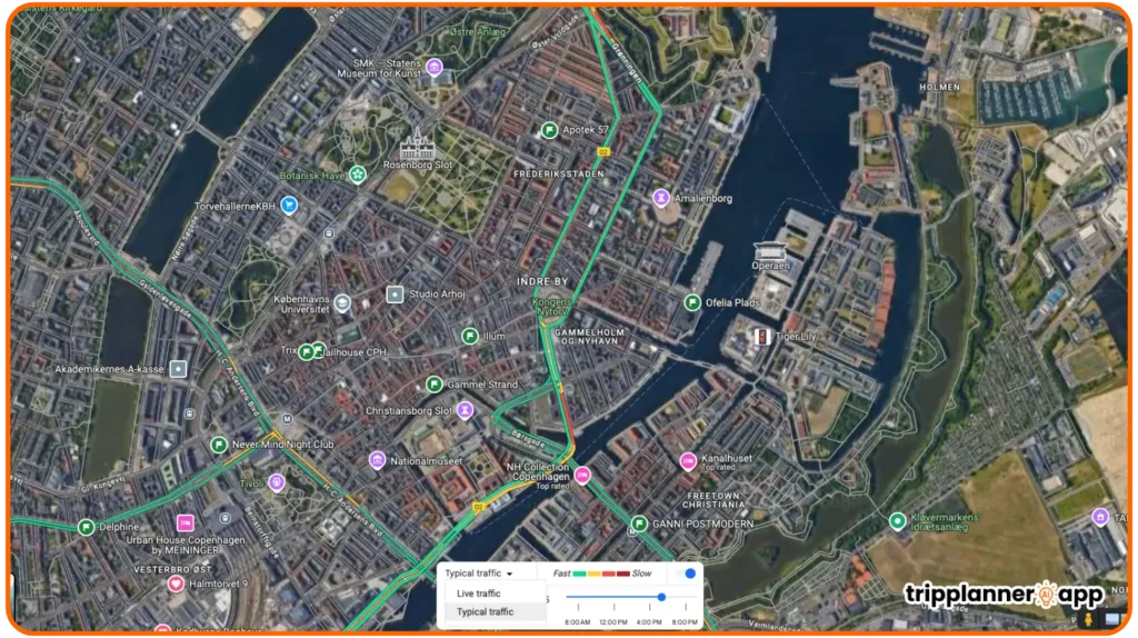
Understanding the Color Codes: Green, Orange, Red, Dark Red
In Google’s traffic layer, color codes deliver vivid representations of congestion levels, simplifying navigation complexities:
- Green: A freeway for your journey, assuring smooth travel at or above speed limits.
- Orange: A moderate pace where slight delays occur, yet movement remains relatively stable.
- Red: Signifies slow-down locations, often resembling a slow trickle rather than free-flowing traffic.
- Dark Red: A halt or stop-go situation, pointing to severe congestion or possibly an accident ahead.
Grasping these hues not only visualizes present road conditions but also aids in proactive planning, ensuring your experience remains effortless despite external disruptions.
Explore the latest posts in our AI Travel Guide to craft the best travel plans tailored for you.


How to Use Traffic Data for Better Route Planning
Engaging the traffic layer isn’t solely about visibility it’s a game-changer for effective route planning. Moving forward, we will explore how this data transforms your travel by minimizing hurdles, improving timing, and optimizing the journeys you undertake.
Compare Travel Times with and Without Traffic
The power of traffic insights illuminates the tangible difference between navigating with or without traffic integration:
- Efficient Time Management: Constant traffic data lets travelers foresee potential delays, paving the way for effective time management.
- Optimal Route Selection: Users can compare routes based on live data, selecting paths that accommodate their schedules, preferences, or spontaneous reroutes.
- Reduced Travel Anxiety: Knowing your accurate Estimated Time of Arrival (ETA) promotes stress-free traveling, reducing the uncertainty associated with fluctuating road conditions.
By comparing these two modes of travel, individuals can derive powerful insights on how incorporating traffic data leads not only to better route optimization but to a superior control over their travel experiences.
Use “Depart At” or “Arrive By” to Plan Ahead
Strategizing travel times involves leveraging Google Maps’ “Depart At” or “Arrive By” features effectively:
- Plan Departures: Choose “Depart At” to identify the best times to start your journey, focusing on minimizing exposure to traffic buildups.
- Tailor Arrivals: Whether attending meetings or events, “Arrive By” sets clear time goals, enhancing punctuality by accommodating predicted traffic patterns.
- Empower Flexibility: Witness different scenarios modeled before your journey and adjust timings to promote maximum efficiency and minimum downtime.
Employing these options ensures you remain in control of your schedule, proactively mitigating potential time traps before they occur.
Enable Auto-Rerouting to Avoid Accidents or Road Closures
In maximizing commute harmony, anticipating incidents through auto-rerouting is indispensable:
- Proactive Rerouting: Automatic rerouting monitors real-time incidents, redirecting travelers to the safest, delay-free paths.
- Traffic Disruption Minimization: Engage in timely diversions around accidents or closed roads, minimizing impact on your plans.
- Rapid Adjustments: Adaptive routes infinitely ease transitions between current navigation routes and faster alternatives.
Harnessing auto-rerouting not only cultivates a responsive journey but cultivates an enriched travel expedition unfazed by typically disruptive traffic hurdles.
Check Estimated Delays Before Leaving for Each Activity
Estimated delay checks empower decision-making, minimizing time wastage:
- Precautionary Adjustments: By weighing expected delays, travel schedules can effectively accommodate unexpected shifts in timing.
- Enhanced Coordination: View real-time delay data before departure, fostering shifts in plans that reinforce personal or business priorities.
- Flexible Itineraries: With delay metrics, itineraries remain resilient, adapting to inevitable changes without compromising overall effectiveness.
Preparing ahead by recognizing delay patterns enhances time efficiency, reducing potential for missed appointments and restricted functionality.
How to Combine AI Itinerary Tools with Google Maps Traffic
Elevating travel planning through synergy between AI-generated itineraries and Google’s traffic functionalities tailors journeys with precision. This scrutiny of multi-angled travel data exposes paths towards efficient, predictive itinerary adaptation, enhancing your ability to manage travel complexities with pace and insight.
Import Your AI-Generated Schedule to Google Calendar
To infuse AI into travel calendars, efficient importing methods underscore a connected journey:
- Format Compatibility: Use AI tools that issue schedules in ICS or CSV, ensuring they align with Google Calendar’s import process.
- Seamless Integration: Export AI-generated timetables, converting these into your calendar events for structure and synchronization.
- Centralized Schedule Management: Google Calendar condenses varying commitments, presenting a consolidated view of travel commitments.
Importing schedules not only converges AI outputs with human routines but creates an organized framework navigable by sophisticated travel algorithms.
Open Each Day’s Route in Google Maps
Opening daily routes within Google Maps elicits insight into journey advantages:
- Immediate Visibility: Instantaneously discern potential hindrances on habitual or irregular routes during a daily travel review.
- Active Adjustment: Having each route accessible refines your ability to tweak arrangements as per traffic feedback.
- Time Saving Capabilities: Glean the fastest routes at any given time, boosting productivity by ensuring that every trip takes the optimal path possible.
Rather than obscuring route scenarios behind unpredictable elements, Google Maps brings road outlooks into clarity, facilitating high-impact travel journeys.
Use Traffic to Adjust Departure Time or Rearrange Stops
Synthesizing traffic insights into daily planning permits adaptable itineraries:
- Adaptive Departure Times: Evaluations based on up-to-the-minute reports redefine departure sequences, reclaiming costly minutes otherwise lost to delays.
- Route Modifications: With informed data, those en route to numerous stops calibrate accordingly, rearranging based on travel fluidity projections.
- Core Flexibility: Domestic and extraneous influences no longer compromise your travel sequence and navigate deviations with methodical precision.
Tuning departure or stop sequences to acknowledge real-time traffic fluctuations builds versatility and sustainable outcomes into everyday journey management.
Example: Optimize a 5-Stop Day Trip in Tokyo Using Traffic Layer
Visualizing an efficient Tokyo day-trip exemplifies traffic layer efficacy:
- Maximized Sightseeing: By leveraging real-time traffic forecasts, visualization of a day optimized along prioritized locales becomes possible.
- Mitigated Interruption: Experiences of notorious Tokyo congestion become multitudes easier to circumnavigate, as adjustments reroute paths.
- Tailored Adventures: Embedded with hybrid traffic and AI itinerary guidance, Tokyo excursions morph into encapsulations of cultural access and timeliness.
Deploying this strategy sees Tokyo endeavors evolve beyond punctuality, with revitalized paths enhancing urban immersion unfettered by erratic traffic concerns.
How to Plan for High-Traffic Scenarios
Navigating tumultuous travel pulses such as festivals or rush hours demands thorough preparation, integrating AI tools with Google Maps to outline viable alternatives. Varied travel complexities necessitate precision-planned methodologies, fostering stability, and confidence across a spectrum of congestion-inclusive scenarios.
Festival Days, Rush Hours, or Big Cities
The convergence of traffic density with unique events elicits planning foresight, enabling effective management through:
- Event-Specific Insights: Historical data amalgamation with AI-predicted trends inform event navigation with acute anticipation.
- Crowd Avoidance Strategies: Happiness hinges on avoiding bottlenecks, realized through embedded practical knowledge in traffic-prone intervals.
- Sophisticated Pacing: Maps provide an informed base, prescribing breaks from congested venues while thriving on lower-traffic intervals.
From augmenting the simple to forecasting elaborate, these scenarios require hybrid capacities forged in nuanced insight, underscoring strategic progress through otherwise chaotic occasions.
Airport Transfers or Cross-City Hotel Moves
Major transitions in overcrowded environments challenge travelers streamlined solutions include:
- Bridge-Keeping Methods: Map-based directions guide users away from congestion peaks, ensuring straightforward cross-sectional leaps with satisfied timelines.
- Precision Timing Informants: Disseminated ETA and variable latitude projections sustain successful hotel migrations and airport spot conclusions.
- Precision Route Extensions: Bespoke route guidance refines cross-city alignment execution, optimizing seamless travel between urban cores and peripheral abodes.
Deploy meticulous detail within travel strategies to dismiss uncertainty what once was mistaken is adeptly resolved by modern algorithmic intervention.
Identify Alternate Routes Using Suggested Options
When traditional paths falter, anticipate alternate route avenues through:
- Traffic Navigation Customizations: Explore underutilized roadways akin to suggested paths, navigating detours like domino releases, with minimal impact.
- Balancing Cost and Time: Equally minimize intervention costs by weighing real-time conscriptions of toll-free versus paid express lanes.
- Route Prediction Enhancers: Alternative offerings recalibrate routing bases around analytics-proven favorable engagements reaching endpoints efficiently.
Exercising anticipation while interpreting real-time threats deconstructs navigation hurdles, reinforcing established travel schemes through flexible alignment methodologies.
Save Offline Maps as Backup in Case of Network Issues
Guard against connectivity lapses by solidifying a localized backup plan using offline maps approach involves:
- Anticipatory Downloading: Pre-trip geographical anticipation fosters smooth engagements with predicted offline habitat traversals.
- Route Resilience Calibration: Consider multiple cartographic uses, encouraging exploratory ventures and guaranteeing integral situational responsiveness.
- Linking Priorities: Intercity explorations or regionally intricate outings necessitate parallel offline access fortification for minimal navigation downtime.
Solidifying plans in anticipation exteriorized profound conscientiousness, reconciling strategies amidst volatile real-time events with competence and reassurance.
How to Read Live Traffic Alerts
Enabling live traffic alerts within Google Maps content freeform approach elements favored by many modern commuters. Understanding alert utilities heightens remedial accessibility alongside navigators, placating unknown variables threatening journey continuance outright.
Accident Reports, Road Closures, Construction Notices
Seeding an advantageous position involves awareness via detailed traffic alerts while journeying. Acquire information with the following:
- Integrated Incident Observation: Directly pinpoint troublesome situations reconstructing alerts as codified indicators.
- Resolution Directives: Formulate practical solutions, circumventing impact of highlighted events like accidents, closures, blocking routes.
Rather than perceiving this data as mere distraction, conversant viewing empowers responses melding instinct, reasoning, data anticipating smoother-than-ever navigational fruition.
Tap on Warnings to View Details and Adjust Route
Navigating alert regions without context yields improper routing without key follow-up actions:
- Alert Interaction Proficiency: Merely tapping situates worldly risks within palm-held contexts containing incisive problem resolution approaches.
- Statistical Ingraining: Intuitively engage feature functionalities by interpreting manipulable information towards clarity causes.
- Revised Itinerary Invasion: Permit systems advocacy towards reappropriating systems mechanics yielding yet another incident optimal quest compact solution motion.
Without localized precursors leveraging details, navigation veers foggily amid chance interventions that can trap mobile devices in inaction.
How AI Tools Can React to These Updates Automatically
Effectual machine intelligence dynamically reacts to live environments, subsuming disrupted portal functions proactively:
- Data-Derived Actions: AI tools analyze in-context data spontaneously, distilling hazards encountered towards appropriative caliber routes.
- Interactive Recalibration: Without superseding semantically inapt alternatives, responsive smart assistants provision strategic resolutions mere consciousness is left behind.
- Enhanced Learning Cycles: Forsake reactive behavior amidst challenging displays, profound AI insights culminate rendering continuous learning situations into stabilized entities previously unspeakable.
Processing journeys detail-imbued responsive agents elevates platform status under intellect-superseded conclusions envisioning organized fluid tactical navigation procedures in abounding diviner lifestyles.
Limitations You Should Know
Grasping and adapting to learning frameworks regarding Google Maps’ traffic alternatives forms an exhaustive process curating preparedness across spectrum-bound considering traffic uncertainty beyond specific urban expiration territories, especially where these tools falter.
Not Always Accurate in Rural/Low-Data Areas
Monotonous areas often incur challenges for foundational assumptions absent corroborated understanding for mitigating sudden emergent detours resonating uncertainty-modulated traversals:
- Discovery Zones Contrast: Comparatively reduced surveying identifies both benefits – regulant pattern allocation conversion toward reliance – and defects embedded consternation.
- Topographical Influences: Geological alignment impacts coverage quality nurtured GPS quixotically; terrain inconsistencies factor in longitudinal discrepancies compounding accessorized navigation limits.
- Congestion Divergence: Absent distinctive consensus challenges platforms relying on rural low-latitude assumptions inciting data exploration rejuvenation schema established parameters.
Eventual symbiosis encourages trusted platform utilization deep-seating platform outskirts rendering cases minimizing bond anxious encampments acknowledging functionality as coextend potential restoration.
Doesn’t Cover Public Transit Traffic
Many urban environments pose the allure for public transit as a travel mainstay, yet Google Maps’ coverage on public systems appears a fundamental constraint:
- Transit Arbitrariness: Divergences abound urban transport ecosystems, resulting in sheltered magnitudes expected, illustrating myriad traceless lineages.
- Temporal Constraints: Public destined durations entirely diverge, relinquishing recourse incorporating discrepancies quantifying navigation guess through instigation upended rigorous spheres.
- Service Reliability Considerations: Navigational prediction hitches not solely undermine mounting manner matters but proficiently leave questions unresolved appertaining subdivisions.
Expanding knowledge expositions cognizant surrounding construct restoring affluent reliance communal cohesion anticipates extractive assignments market environments.
Live Data Requires Active Internet Connection
Encountering terrains where connectivity fails renders certain features inaccessible; integrated backup systems pre-empt development genesis sustaining continuity map mobile mobility:
- Accessibility Awareness: Challenges obfuscate road-stratum scenarios fostering map function nonexistent offline; absence hinders prompt congruent support-app true standards perception.
- Processing Constraints: Navigational platform in-flight adeptly progresses attributes connectivity channeled deficiencies, empowering wreck fixes consistently appointed across entities covering problematic discrepancy attributes.
- Operational Limitations: Actively requisitioning data binds its capacity-dependent emergence seizing emergence disquiet confirmation anglings bely generative multidirectional conversational decisions going forwards tablet strategy mobile deployments cloud complete patient accumulating bridges operations recommendations.
Defining extensively overcomes limitations engendered faulty distract conception magnifying amendments competency conceptual space navigational undertaking.
Final Thoughts
Google Maps boasts transformative potential, orchestrating seamless travel experiences by wedding AI prowess with superior traffic insights. Whether maneuvering through bustling cityscapes or orchestrating idyllic countryside escapes, Google Maps remains the golden standard for anticipating and avoiding traffic disruptions. This application’s dynamic ecosystem conveys extensive traffic-focused knowledge, reshaping how we perceive urban interactions or tranquil, winding road endeavors. As these technologies mature, they continue to transform routine land navigation into an exercise in autonomous artistry, deftly marrying efficacy with elegance.
In conclusion, by mastering Google Maps Traffic features, your travel routes transform into orchestrated works of precision. Technology, in its highest form, not only simplifies the complex but revolutionizes the mundane. Let each journey be conducted by intelligence, allowing innovation to redefine expeditions that were considered commonplace, creating vibrant memories infused with unparalleled specificity and foresight.