Imagine planning a trip without the stress of lost directions or missed activities. Picture a tool that not only leads you seamlessly from point A to B but also personalizes your journey based on your unique preferences and past experiences. This is the promise of Google Maps, especially when paired with the latest advancements in artificial intelligence (AI). In an age where travel planning can be intricate and tedious, Google Maps is revolutionizing how we navigate not only cities but also the complexities of itinerary creation, transforming mere trips into unforgettable adventures. With its rich array of features and intelligent recommendations, Google Maps is not just a navigation app; it is an essential partner in creating smarter, AI-driven travel experiences.
Introduction
Google Maps has revolutionized how we approach travel planning, perfectly aligning with AI capabilities to offer a comprehensive toolkit for itinerary building. In an increasingly tech-driven world, the necessity for quick, intuitive, and personalized planning tools has never been greater. Whether you are a seasoned traveler or a first-time tourist, Google Maps provides functionalities that enhance your travel experiences, making logistics simpler and more engaging. This article will explore the integral role of Google Maps in AI-powered trip planning, focusing on its myriad features that enrich user experiences, streamline itinerary management, and ensure that travelers can focus less on planning and more on enjoying their adventures.
Why Google Maps Is Crucial for AI-Powered Trip Planning
Google Maps is no longer just a navigation tool; it has evolved into an indispensable instrument for AI-powered trip planning. Its ability to integrate seamlessly with various AI technologies enhances its functionality and usefulness. Here’s why Google Maps stands out in today’s travel planning landscape:
- Real-Time Updates: One of the key advantages of using Google Maps is its real-time traffic updates. AI algorithms analyze vast amounts of data to predict traffic conditions, route disruptions, and various travel times depending on the time of day. This analysis allows users to make more informed decisions regarding their travel schedules.
- Personalization: By utilizing AI and user preferences, Google Maps can tailor suggestions based on previous locations visited, searches, and interests. This customized approach ensures that users receive recommendations that resonate with their travel aspirations, whether exploring local eateries or iconic tourist spots.
- Integrated Services: Google Maps thrives on its seamless integration with other Google services. This includes Google Calendar for scheduling trips and Google Docs for documenting itineraries. Users can effortlessly share their travel plans and collaborate in real-time, making group trips more enjoyable and organized.
- Comprehensive Location Data: AI technologies analyze user behavior and geographical data on Google Maps to offer insights that traditional maps simply cannot match. This includes user reviews, photos, and even busy hours, allowing travelers to plan visits strategically and avoid crowds.
- Efficiency Through AI Tools: The incorporation of AI itinerary builders within Google Maps platforms ensures that trips are not only well-planned but also catered to user preferences. Enhanced functionality allows users to explore multiple destinations while keeping their interests and travel history in mind.
How It Complements AI Itinerary Builders
Google Maps complements AI itinerary builders in several significant ways, resulting in a smoother planning experience and enhanced personalization:
- Screenshot Recognition: One innovative feature powered by AI is the screenshot recognition capability. When a user takes a screenshot of an attraction or destination, Google Maps can identify and organize this information, allowing users to compile their travel interests effectively. This feature eliminates the manual gathering of information, providing a streamlined approach to trip planning.
- Creating Custom Lists: Users can leverage Google Maps to save locations that intrigue them. The ability to create custom lists helps in organizing trips, ensuring that travelers can efficiently categorize locations (e.g., restaurants, landmarks, accommodations) and revisit them later. Additionally, users can share these lists with travel companions, facilitating group coordination.
- AI-generated Itineraries: AI trajectory planners within Google Maps can automatically generate detailed trip itineraries based on specific user queries. By considering user inputs, such as interests and previous visits, Google Maps creates interactive itineraries that include attractions, user-generated photos, and comprehensive reviews.
- Exporting Itineraries: Once the AI itinerary is created, Google Maps allows the easy exportation of these plans into Google Docs or Gmail. This integration enables users to share their itineraries with friends, family, or colleagues conveniently. Notably, this feature is invaluable for collaboration and ensures everyone involved in the trip has access to the same detailed information.
- User-Friendly Adjustments: As plans evolve or change spontaneously, users can modify their itineraries easily on Google Maps. The application allows users to shift between activities or modify the timeframe based on weather and real-time updates, ensuring ultra-efficient trip management.
Key Features that Support Trip Itineraries
Having identified the importance of Google Maps in AI-powered trip planning, it’s essential to delve into some of the key features that support this journey. Google Maps provides a wide array of tools designed specifically to enhance the travel planning experience.
Real-Time Location Search and Ratings
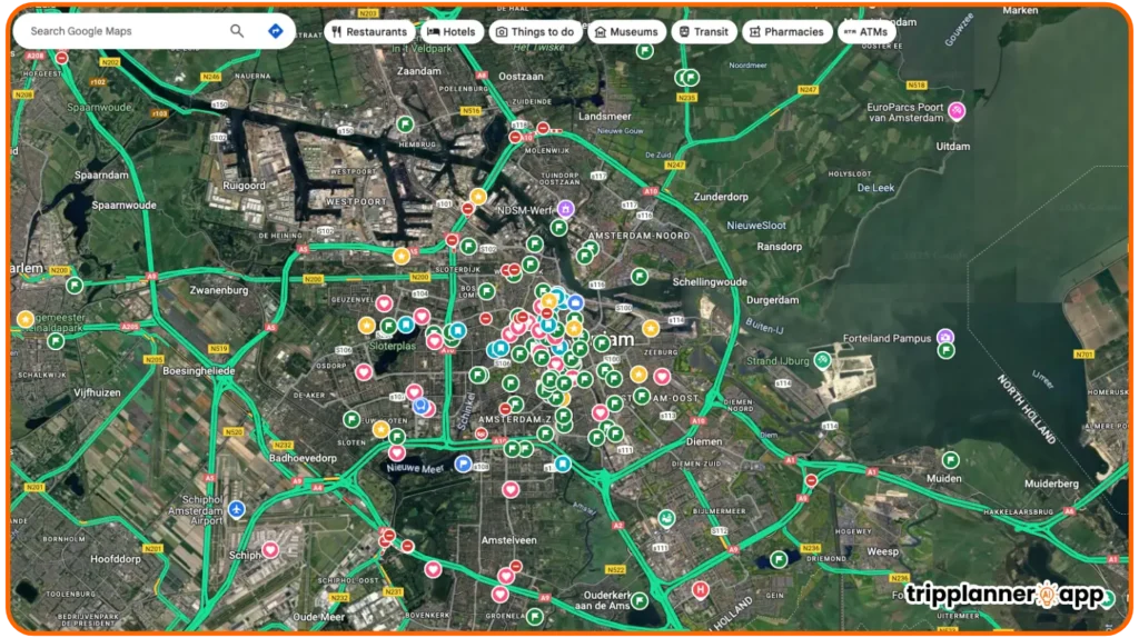
Google Maps is synonymous with real-time location search, providing users with immediate access to crucial information about nearby businesses and attractions. This feature allows users to find places of interest based on specific queries or loose criteria. Here’s how it enhances trip planning:
- Immediate Access: Users can quickly identify local attractions, restaurants, or services like gas stations and pharmacies. The instant access to hours of operation, contact details, and user reviews shapes smarter travel decisions.
- User Ratings and Reviews: Google Maps incorporates an extensive database of user-generated ratings and reviews. These contributions can guide travelers in choosing the best dining options or attractions, as potential visitors can evaluate prior experiences before making commitments.
- Nearby Searches: The nearby search function can identify multiple options within a particular radius or location. This is especially useful when travelers are in an unfamiliar area and need to find essential amenities quickly, such as:
| Type of Service | Examples |
| Restaurants | Local diners, fast food chains |
| ATMs | Banks or credit unions |
| Pharmacies | Chain pharmacies, mom-and-pop shops |
- Comparison and Decision Making: With accessible ratings and user feedback, travelers can conveniently compare various options side by side. This seamless evaluation process enhances decision-making efficiency, allowing travelers to choose based on quality and value rather than guesswork.
- Geo-Tagging Features: Many reviews on Google Maps include geo-tagging features, where users can attach photos or memories associated with specific locations. This feature adds a layer of authenticity and context, helping travelers form a more comprehensive picture of their options.
Turn-by-Turn Directions for Multiple Transport Modes
One of the standout features of Google Maps is the provision of turn-by-turn directions for various modes of transportation. This functionality caters to diverse travel preferences, ensuring that all users, whether driving or using public transport, can navigate seamlessly. Here’s what sets this feature apart:
- Diverse Transport Modes: Google Maps supports numerous transportation modes, including driving, biking, walking, and public transit. This flexibility ensures that users can select alternatives according to their needs and circumstances. For example:
| Mode of Transport | Use Cases |
| Driving | Long trips, family vacations |
| Walking | Exploring city centers, short stops |
| Biking | Eco-friendly trips, park tours |
| Public Transit | Commuting, budget-friendly travel |
- Detailed Guidance: Turn-by-turn directions provide comprehensive road information. Users see the expected travel times, alternative routes, and upcoming intersections, ensuring they are well-prepared at each step of their journey.
- Real-Time Traffic Updates: Google Maps monitors live traffic conditions to suggest the fastest routes available. If users take a wrong turn, the application recalculates their route and provides new directions, ensuring they stay on track regardless of unexpected changes.
- Efficient Travel Planning: Users can plan routes in advance and take into account factors such as peak traffic times or road construction, ensuring that they can manage their travel schedules proactively.
- Advanced Features: The platform goes beyond mere directions, providing information about local traffic incidents, road conditions, and estimated arrival times, making every journey as predictable and enjoyable as possible.
Nearby Search: Restaurants, ATMs, Pharmacies, and More
The ability to conduct a nearby search is a core function of Google Maps that significantly enhances user experiences during their travels. This feature enables users to easily locate essential services and amenities as they navigate unfamiliar environments:
- Sustenance on the Go: Travelers often seek dining options while exploring. The nearby search function provides a comprehensive list of restaurants that meet various tastes, ranging from quick bites to fine dining. Users can further filter these options through cuisine types:
| Cuisine Type | Some Restaurant Examples |
| Italian | Olive Garden, Local Pizzeria |
| Asian | Sushi Place, Thai Express |
| Vegan | Vegan Bistro, Health Food Cafe |
- Safety and Security: Finding ATM machines and pharmacies can be critical, especially when traveling abroad. Users can rely on Google Maps to identify secure ATM locations and nearby pharmacies for emergencies, ensuring they remain protected and prepared.
- Accessibility Features: Google Maps includes essential accessibility features, offering options for users with disabilities. Notes on wheelchair accessibility for restaurants or public transportation options make it easier for everyone to enjoy their travels without additional barriers.
- Offsetting Stress: The ability to locate nearby services reduces travel-related stress, especially during emergencies or when plans unexpectedly change. For instance, finding a pharmacy in a foreign city or locating a restaurant during odd hours can be less daunting with Google Maps.
- User Reviews and Insights: Alongside locations, users benefit from insights drawn from user reviews, allowing them to gauge the popularity and reliability of nearby services. This information can often guide travelers to the best local providers for their needs.
Street View and 360° Virtual Preview
Google Maps’ Street View and 360° immersive preview features serve as transformative tools for travel planning. By offering users a virtual glimpse into locations, these features dramatically enhance the trip planning experience:
- Exploration Before Arriving: Street View allows users to virtually explore their destinations before visiting. This feature can be particularly beneficial for understanding the layout of a site, such as a restaurant or historical landmark, allowing travelers to feel more comfortable upon arrival.
- Realistic Experience: By providing panoramic images, Google Maps lets users visualize their surroundings in real-time. The immersive nature of this functionality allows them to familiarize themselves with potential entry points, parking options, and local vibes.
- Enhanced Planning: Travelers can use these images to gauge whether certain places fit into their expectations and interests. The ability to “visit” a location virtually can save time and resources by helping users prioritize highly rated choices for their itineraries.
- 360° Previews: The 360° viewing option provides users with a dynamic layout of the area, promoting engagement with potential attractions. This feature helps users visualize their routes, local amenities, and nearby attractions effectively.
- Attractiveness to Travel Enthusiasts: For photography enthusiasts or social media creators, Street View offers visually appealing content possibilities. The ability to share unique views or stunning architecture enhances their social media presence and travel narratives.
Save, Label, and Share Locations
Google Maps enables users to save, label, and share locations, effectively transforming the app into a personal travel diary. This feature is especially useful for planning and organizing itineraries:
- Pinning Destinations: Users can easily “drop a pin” to mark specific locations that catch their attention. This functionality allows for quick retrieval later when compiling a travel route.
- Custom Lists: Through Google Maps, users can create themed lists to categorize their saved locations. For example, a user going to Paris might create lists such as “Cafes to Try,” “Must-See Landmarks,” or “Shopping Centers.” This organizational structure streamlines the itinerary-making process, ensuring users have everything they need at their fingertips.
- Sharing with Friends and Family: Google Maps makes sharing these custom lists easy. Travelers can send their curated lists to friends or family via email or social media, allowing everyone involved in the trip to stay in sync and have access to the same essential information.
- Color-Coding Recognitions: Users can assign color-coded markers for different location types, enhancing clarity and providing instant recognition of categories. For instance, users can designate one color for restaurants and another for attractions, making it easier to visualize their plans.
- Collaborative Features: In an age of group travel, having collaborative capabilities in Google Maps means all participants can contribute their suggestions and alter itineraries collectively. This collaborative approach adds a layer of excitement to travel planning, ensuring everyone’s interests are considered.
Read reviews of other AI trip planners and support tools to help you plan smarter.

EasyTrip AI: Transform Travel Planning with Personalized Itineraries
EasyTrip AI is reshaping the future of travel planning with its sophisticated AI-powered itinerary planning capabilities. In a world where personalized experiences are valued over standard travel packages, EasyTrip AI [...]


Route Optimization and Planning
Having discussed the key features supporting trip itineraries, we now turn our attention to how Google Maps optimizes routes and enables strategic planning. The platform excels in providing users the tools they need to plan efficient travel routes.
Creating Multi-Stop Routes for Daily Travel
Creating multi-stop itineraries can transform an ordinary day trip into an adventure full of exploration. Google Maps allows users to organize multiple stops into a single journey, enhancing the overall efficiency of daily travel:
- Adding Multiple Destinations: Users can plan routes with up to 25 different stops. This functionality is particularly useful for day tours or city explorations, allowing users to visualize their travel plans without unnecessary confusion or detours.
- Manual Rearranging: While Google Maps provides optimized routes, users can manually rearrange their stops to create a more logical journey or visit specific locations in a preferred order. This flexibility accommodates individual travel preferences and spontaneity.
- Feedback on Travel Time: Google Maps calculates real-time travel estimates based on various factors such as the time of day, weather, and traffic congestion. This information aids users in selecting the most efficient path between stops, promoting more enjoyable and stress-free journeys.
- Detailed Directions: Step-by-step directions provided by Google Maps ensure that every traveler feels confident about their route. The app guides users smoothly through their itinerary, making adjustments when necessary, such as alerting them of traffic delays.
- API for Businesses: For companies with fieldwork, Google Maps API facilitates multi-stop route optimization tailored to logistics and delivery needs. Businesses can manage fleet routes more effectively, optimizing fuel efficiency and minimizing travel time.
Estimating Travel Times by Car, Walk, Transit, or Bike
A critical aspect of route planning is having accurate estimations of travel times for various transport modes. Google Maps excels in providing users with these insights:
- Comparative Analysis: Google Maps evaluates different travel modes to present the best options for users, considering factors such as traffic conditions and journey duration. Users have the choice between driving, walking, cycling, or using public transit based on their preferences or constraints.
- Active Traffic Monitoring: The intelligent algorithms embedded in Google Maps constantly monitor live traffic conditions. For car travel, this means users receive the most accurate estimates by avoiding congested areas and recalibrating routes on the fly.
- Walker and Biker Recommendations: For pedestrians and cyclists, Google Maps provides the best paths that prioritize safety and convenience. Users can explore quieter roads, trails, or designated bike lanes for their itineraries.
- Comprehensive Public Transit Information: Users planning to use public transportation benefit from Google Maps’ transit schedules, including departure times and transfer points. This integration ensures they have everything they need for smooth travel.
- Scenario Planning: An additional feature allows users to toggle between multiple transport modes when entering their destination. Doing so enables them to strategically assess their options and embark on journeys tailored to specific experiences or time constraints.
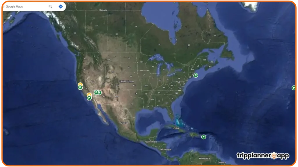
Distance Calculation Between Destinations
Distance calculation is a fundamental aspect of travel planning, and Google Maps offers robust functionality to assist users in determining how far apart destinations are:
- Route Analysis: Users can simply input desired locations to generate distance measurements and travel time estimates. This functionality is invaluable when planning itineraries and ensuring all destinations are realistically achievable within the planned time frame.
- Multiple Destinations: When users add multiple stops, Google Maps provides a cumulative distance for the journey, enabling travelers to prioritize closer attractions and identify the best sequence for their visit.
- Real-World Applications: For service-oriented industries, this feature serves as a powerful analytical tool for assessing logistics, transportation, and delivery. Businesses can design optimized routes and inform clients about estimated delivery timelines accurately.
- Custom Calculations: Users can assess distances for various transport modes, optimizing their journeys based on preferences for speed or scenic routes. This customizability enriches their experiences as their choices determine their paths.
- Customizable Routes: For more engaging travel experiences, users can input personal details to achieve tailored distance calculations, such as preferred routes or alternate destinations they may want to explore.
Offline Maps for Remote or International Travel
Google Maps recognizes that not all environments guarantee consistent internet connectivity, especially during international travel or trips to remote areas. Therefore, the platform has integrated powerful offline map functionalities for its users:
- Downloading Maps: Users can download specific areas within Google Maps to access detailed routes without needing an internet connection. This capability ensures free navigation without exceeding data limits or worrying about connectivity issues during travel.
- Navigating Without Data: Offline maps can still provide crucial information such as landmarks, businesses, and routes. Users do not have to stress over losing essential details or directions while on the go.
- Preloaded Information: Users can select and save comprehensive maps of regions they intend to visit in advance, ensuring that they have access to all necessary navigational features even without live updates.
- Emergency Assistance: Offline capabilities are particularly beneficial in emergencies. Travelers can still locate essential services such as hospitals, gas stations, or restaurants without internet access, providing peace of mind during unpredictable situations.
- Cross-Platform Availability: Google Maps offline features function seamlessly across devices, enabling travelers to download maps on one device while accessing it on another, enhancing user experience and flexibility.
Trip Personalization Support
As we continue to explore the capabilities of Google Maps, it’s crucial to identify how the platform enhances trip personalization. Personalizing the travel experience greatly enriches user satisfaction and engagement.
Custom Maps via “My Maps” (Trip Day Mapping)
Google Maps’ “My Maps” feature allows users to create personalized maps tailored to their trip needs ideal for those looking to fine-tune their travel experiences:
- Creating Personalized Maps: Users can design their unique maps directly via the Google Maps platform. They can mark specific attractions, restaurants, and accommodations essential for tailored itineraries.
- Layering Destinations: One of the most useful functionalities within My Maps is the ability to create distinct layers for different days or themes. For example, one layer could focus on historical sites visited on Day 1, while another could emphasize culinary experiences on Day 2.
- Integrated Notes and Images: Users can incorporate notes, descriptions, or relevant images for each location marked. These personalized touches enhance the overall clarity of travel plans, serving as effective reminders of what each destination offers.
- Shareable and Collaborative: Once created, users can share their maps with friends, travel companions, or family members. This feature promotes collaborative planning, helping everyone involved stay informed and engaged in the trip-building process.
- Convenient Navigation: The mapped destinations within My Maps can be used for real-time navigation, ensuring that users remain organized and focused on enjoying their journey rather than getting lost.
Color-Coded Pins and Personalized Labels
One of the unique aspects of Google Maps is its color-coded pins and personalized labeling, enhancing the visualization of trip plans:
- Enhanced Clarity: By using color-coded pins, users can categorize various destinations or points of interest. This approach significantly simplifies navigation and makes it easier to group activities based on themes (such as dining, sightseeing, or shopping).
- User-Friendly Interface: Pinning locations with distinct colors and labels fosters a more interactive and engaging planning experience. Users can quickly identify specific points of interest and locate them on the map without confusion.
- Thematic Yardsticks: For example, users could designate blue pins for museums, green for parks, and yellow for dining. This visual distinction aids in creating thematic bucket lists while ensuring that each trip aspect is well-rounded.
- Targeted Personalization: Color codes enable users to create personalized experiences that resonate with their individual travel styles. To enrich the journey, travelers can choose color themes or designs that mirror their personality or interests.
- Visual Collaboration: For group trips, this feature allows all participants to add relevant labels and markers, contributing to comprehensive planning. This collective effort often results in more vibrant and well-rounded travel experiences.
Collaborative Planning with Shared Maps
Google Maps’ shared maps feature promotes collaborative planning, ensuring that everyone in a travel group can participate and contribute their ideas:
- Easy Map Sharing: Users can share their custom maps with any Google account holder. This sharing ability fosters teamwork, making the planning process feel less burdensome and more inclusive.
- Collaborative Contributions: When a group collaborates on a shared map, participants can add their pins, leave comments, and make suggestions about locations or activities to be included in the itinerary.
- Live Updates and Modifications: Shared maps allow for live alterations in itineraries. Users can continuously update and adjust their plans based on feedback, ensuring the trip stays dynamic and adaptable to changing circumstances.
- Visual Synchronization: All group members can see updates in real-time, ensuring everyone is on the same page regarding plans without having to frequently check in via text or other forms of communication.
- Increased Engagement: This collaborative approach promotes a sense of shared experience before the trip even begins. By actively participating in the planning process, everyone feels more connected to the forthcoming adventures.
Timeline and Activity History for Trip Review
Google Maps’ timeline feature serves as a trip diary, tracking where users have been and what they have done. This functionality is particularly useful for planning future adventures:
- Detailed Activity Logs: Users can access a chronological record of past trips and locations they’ve visited. This historical insight is invaluable when planning new trips, as it helps travelers remember past experiences.
- Reviewing Travel Preferences: By revisiting the timeline, users can analyze their travel preferences and interests, helping them refine their future itineraries based on what they enjoyed the most.
- Integrating Longevity: The timeline also allows travelers to recreate memorable trips, helping them plan similar experiences in the future. By keeping a historical account of places visited, Google Maps encourages deep engagement with the surrounding world.
- Visual Mapping: Through the timeline, it’s easy to visualize routes taken during each trip, encouraging users to explore new journeys that align with their previously enjoyed paths or create entirely new experiences.
- Personalized Recommendations: Google Maps leverages timeline data for personalized travel suggestions. Based on past trips, users can receive tailored recommendations that align with their interests, enhancing future travels.
Google Maps + AI Itinerary Tools: A Powerful Combo
The collaboration between Google Maps and AI-based itinerary tools creates a robust framework that enriches the travel planning experience. The combining powers of real-time location data with artificial intelligence define a new frontier in seamless travel experiences.
How AI Tools Use Google Maps API for Smart Suggestions
AI-powered itinerary tools leverage Google Maps API to offer intelligent recommendations that enhance your travel plans significantly:
- Data-Driven Insights: AI tools utilize API data from Google Maps to deliver customized suggestions based on users’ past behaviors and preferences. This integration allows for highly tailored journey planning that considers the user’s unique travel history.
- Dynamic Updates: The combination of real-time data and machine learning algorithms enables AI tools to provide continuously updated recommendations. Whether considering changing plans or exploring a new area, users receive timely advice based on their requirements and surroundings.
- Smart Location Selection: AI itinerary tools can suggest attractions or activities that align with user interests, optimizing choices based on geographical proximity. These intelligent selections ensure that users maximize their experiences without missing out on vital opportunities.
- Integration of Multiple Sources: The synergy between various APIs allows AI tools to access extensive databases. By combining information from Google Maps with other sources, AI can enhance the travel experience, ensuring users are never short on innovative ideas.
- User-Centric Tailoring: AI-driven tools create bespoke itineraries that actively consider user preferences, previous visits, and interests. This focus results in travel plans that speak to users on a personal level rather than generic recommendations that miss the mark.
Embedding Routes, Locations, and Prebuilt Days
AI tools serve to enhance Google Maps’ itinerary capabilities by embedding pre constructed travel plans that help users navigate seamlessly through their adventures:
- Prebuilt Itineraries: Many AI itinerary tools incorporate templates containing well-curated days filled with activities. Users can select options that appeal to them without having to start from scratch.
- Route Integration: Available routes are seamlessly integrated into the suggested itineraries. Users can view their planned day alongside suggested travel paths for better clarity and engagement.
- Flexibility in Adjustments: When users opt for prebuilt plans, they can make adjustments based on their preferences. This ability to modify schedules boosts user control, ensuring their travel experience remains tailored to their desires.
- Visualization of Options: AI tools enhance visualization aspects by showing potential routes, locations, and landmarks graphically. This feature simplifies users’ understanding of each day in their itinerary, making alignment of expectations easy.
- Interactive Mapping: By embedding these features, AI tools enable users to interact with potential locations and experiences in real-time. This dynamic approach engages users in seamless navigation while planning their journey.
Exporting Google Maps Data to AI Travel Apps
The process of exporting data from Google Maps to AI travel applications enhances the efficiency of travel planning:
- Integrated Data Workflow: Exporting involves creating a detailed itinerary through AI tools that pull data from Google Maps. This itinerary can include locations, timings, and route maps, creating a cohesive travel plan.
- Simple Export Process: Users can easily download itineraries or lists in CSV format or similar file types. This functionality ensures a straightforward transition between applications, making it seamless to incorporate AI-generated suggestions.
- Streamlined Navigation: Once exported, users can upload data into Google My Maps. This process automates the mapping of suggestions, allowing users to visualize their plans during the journey effectively.
- Enhanced Resource Accessibility: By exporting data effectively, travelers maintain access to their planning resources, ensuring navigation remains smooth and organized. Users have everything in one accessible location, simplifying travel management.
- Case Study in Action: Consider a traveler planning a week in Paris who utilizes AI tools to generate an itinerary. The generated itinerary is exported and uploaded to Google My Maps, showing the traveler a visual representation of their plans, enriching their travel experience.
Pros and Limitations
Google Maps, when paired with AI itinerary tools, offers a unique combination of benefits and potential limitations that travelers should be aware of as they plan their trips.
Pros: Free, Reliable, Global Coverage, Customizable
- Accessibility: Google Maps is free to use, eliminating any subscription fees and making comprehensive navigation solutions available to everyone.
- Dependable Navigation: Users can depend on Google Maps for reliable navigation, with detailed maps that offer precise accuracy and up-to-date information. This trust allows travelers to feel confident in their journeys.
- Extensive Global Coverage: Google Maps has comprehensive map data across the globe, making it ideal for international travelers who require reliable navigation and local information in unfamiliar territories.
- Customizability: The platform allows users to create personalized maps and lists. Travelers can tailor their experiences to fit their needs and interests, rendering planning effective and straightforward.
- Collaborative Tools: The features that enable sharing and collaborative planning enhance the collective travel experience among groups, ensuring everyone can access shared itineraries.
Cons: Battery Drain, Data Dependency, Limited Calendar Sync
- Battery Drain: Extensive usage of Google Maps, particularly during navigation, can lead to significant battery depletion, causing inconvenience during lengthy travels. This is a common concern reported by users.
- Data Dependency: Key features rely on a stable internet connection. While offline maps are available, they have limited functionality, potentially hindering travelers in remote areas with unreliable connectivity.
- Privacy Issues: The collection of user data poses privacy concerns. Users may feel uncomfortable with the tracking of their location history and personal preferences, limiting engagement with certain services.
- Sync Limitations: Google Maps has restricted calendar sync capabilities. Users looking to integrate their travel plans with calendar reminders may find this feature lacking, hindering seamless organization.
- User Experience Gaps: Occasionally, the app may exhibit bugs or glitches that impact performance. Regular app updates can help mitigate these issues, but they still affect overall user experience.
Tips to Use Google Maps Effectively While Traveling
Equipping oneself with effective techniques for utilizing Google Maps can transform how travelers navigate and manage their journeys, enhancing the overall travel experience.
Download Offline Areas in Advance
- Preparation is Key: Travelers should download offline maps in advance when they know they will be in regions with unreliable internet service.
- Search and Download: To download, search for the desired area and select the option to access offline maps. This functionality allows users to retain vital navigation data even without a data connection.
- Area Customization: Users can adjust the specific shaded area they wish to save, ensuring that they download only the necessary maps for their trip, minimizing storage use.
- Data Management: Ensure the maps are refreshed every 30 days by reconnecting to Wi-Fi. This practice guarantees that users have the most updated information when they travel.
- Regular Updates: It is essential to review storage management periodically to remove unutilized maps, ensuring that device storage remains optimal for travel.
Use “Lists” to Group Places by Day or Theme
- Ease of Organization: Creating lists allows travelers to group destinations by category or theme. This organization ensures exploration runs smoothly, as people know which venues or attractions fall into each day’s itinerary.
- Themes and Activities: Users can create different themes (e.g., “Art and History,” “Culinary Discoveries,” “Nature Adventures”) making it visually coherent and simplifying exploration.
- Accessibility for Group Members: Group members can collaborate to create and refine lists, ensuring everyone provides input on potential places to see and experiences to have.
- Informed Decision-Making: These lists not only aid in decision-making but also encourage a structured experience where users can map out their daily adventures easily.
- Visual Representation: The integration of lists makes it easier for users to visualize their entire day, allowing for quick assessments of timing and activity length.
Use Live Location Sharing for Group Trips
- Coordination Made Easy: Enabling live location sharing is extremely beneficial during group travels, facilitating effortless coordination among all members.
- Enhanced Real-Time Communication: Users can update group members on their location in real-time, which can help with meeting points or navigating busy areas.
- Safety and Security: Sharing your location adds an essential layer of safety during outings, allowing families or friends to stay informed about each other’s movements.
- Group Notifications: When implemented effectively, live location sharing ensures that everyone is aware of any changes in plans without needing continuous communication.
- Avoiding Delays: By accurately tracking movements and estimated travel times, users can better coordinate plans and avoid unnecessary delays or confusion.
Check Peak Times and Reviews Before Visiting
- Optimize Timing: Google Maps allows users to check the peak visitation times for specific locations. This feature enables them to plan their trips to avoid large crowds.
- Seasonal Adjustments: Knowing peak times can lead to better planning, particularly during holidays or special events when places may be more congested.
- Diverse User Reviews: Reading user reviews provides insights into past visitors’ experiences, helping travelers assess the quality of service or the atmosphere of a venue before committing.
- Enhanced Alternatives: Should a preferred location be overwhelmingly crowded, Google Maps offers alternative suggestions that can be equally appealing, ensuring users don’t miss out on great experiences.
- Inform Future Trips: Researching peak times and reading reviews proactively informs future trips, giving additional context about what works best based on past data.
Final Thoughts
Google Maps has undeniably blurred the lines between being a simple navigation tool and a comprehensive travel planning assistant. Its integration with AI tools, combined with features that emphasize efficiency, personalization, and collaboration, consistently elevated user experiences. Traveling with Google Maps enhances logistics, assists in curating tailored itineraries, and fosters exploration based on user preferences and past behaviors. As we embrace the future of travel, Google Maps remains a pivotal tool for navigating the dynamic and diverse landscapes we traverse. For travelers eager to transform their journeys and seize every opportunity, Google Maps stands as an essential companion, driving the adventure forward ensuring that no destination is out of reach and that every trip is as enriching and unforgettable as possible.
Still Looking for the Perfect AI Trip Planner?
Discover all the best AI-powered trip planning tools in one place. Whether you need a fast itinerary builder, a chat-based assistant, or a browser extension — we’ve got you covered!
Browse All AI Trip Planners